 Voor kinderen


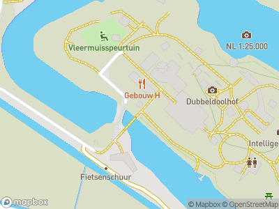
One of the two forts near Asperen is called Fort bij de Nieuwe Steeg, which was built as part of the New Dutch Waterline a clever defence system that could flood large tracts of land to form an effective barrier against invasion from the east. It has recently been restored and renamed the GeoFort where visitors can learn all about cartography, maps and navigation.
Fort on the river Linge
Every fort on the New Dutch Waterline had a unique function depending on the position on which it was built. No two forts were the same.The two forts near Asperen, Fort bij de Nieuwe Steeg and Fort Asperen for example, were intended for the protection of an area of land that lay too far above sea level to be flooded. These forts were given cannons to protect the floodgates along the winding Linge river. The New Dutch Waterline near Asperen is still completely intact and the mechanics of their defensive systems are still visible.
Bombproof barracks
The exposed location of the fort meant that it was susceptible to attack from two sides. This is why the fort was designed with special bombproof barracks. The barracks consisted of two tall buildings built opposite one another, with the two gables only 4 metres apart. This gave enemy shells little chance of hitting the front of either building. The adjoining buildings could be accessed from here, using an underground tunnel the cellars of one building were used for storing ammunition, which could be brought up by a lift, the other was used for the artillery. There is also an old engineering depot and a number of bunkers still on the fort’s grounds.
The GeoFort
In WWII, the German forces successfully bypassed theses Dutch defences by dropping their paratroopers behind the Waterline. This, in effect, brought the military usefulness of the forts to an end. Many of the forts along the Waterline have since been redesignated and Fort bij de Nieuwe Steeg has been turned into the GeoFort. The Geofort offers indoor and outdoor activities that introduce visitors to cartography and navigation. They include experiments with different geo-techniques and there is a bat trail in the gardens, designed by Dutch State Forestry Service (Staatsbosbeheer), for children to play in and explore.